Advanced options and settings
Click the “gear” button to open settings menu.

Cameras

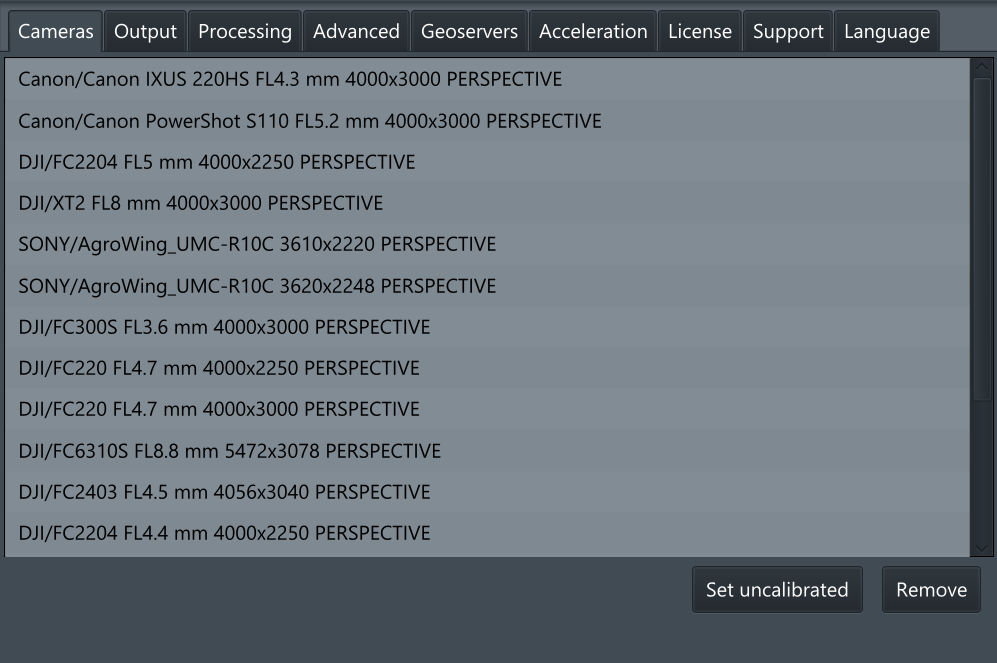
Cameras – The location of the calibrated cameras and preinstalled camera profiles, can be highlighted by right-clicking and clicking “Set uncalibrated” button to reset calibration settings.
Output

File types that will be used as output formats for the complete project.
MBTiles - MBTiles is a file format for storing map tiles in a single file. It is, technically, an SQLite database.
Map/Terrain GeoTIFF - Georeferenced Tagged Image File Format (GeoTIFF) is an open file format and de facto standard based on the TIFF format and is used as an interchange format for georeferenced raster imagery.
Processing

Processing - Exposure correction method
The algorithm is used to compensate for exposure differences on different shots. Note that good shots should not have much difference in exposure. Having it means that photogrammetry shooting recommendations most probably were not followed (e.g. exposure was not set manually, and weather was too shiny with varying lighting conditions).
Histogram equalization - this method tries to equalize the luminance channel histogram for each picture. It is able to smooth local dynamic exposure variations on separate pictures (like cloud shadows). The side effect is a slight color distortion which makes the result look less natural. However this method is the most universal one and thus is default.
Color correction - analyzes exposure difference graph for all pictures at once and selects correction factor for each picture. The difference is estimated for a whole picture, the correction factor is also applied to a whole picture. It means that local dynamic exposure variations cannot be effectively smoothed. This method usually produces a bad results for pictures with too significant exposure variation. For good pictures it may produce the best result, preserving natural colors and shading.
None - do not attempt to fix exposure difference. Use it if the original pictures are required, or other methods produce unacceptable results.
Advanced

Image size for feature extraction - images are downscaled to this size before feature detection and extraction. Downscaling discards small details, leaving larger ones for detection. Reducing this parameter value may help to improve results for photos with overwhelming high-frequency noise (e.g. trees, bushes, high grass; wind usually makes it even noisier).
Geoservers

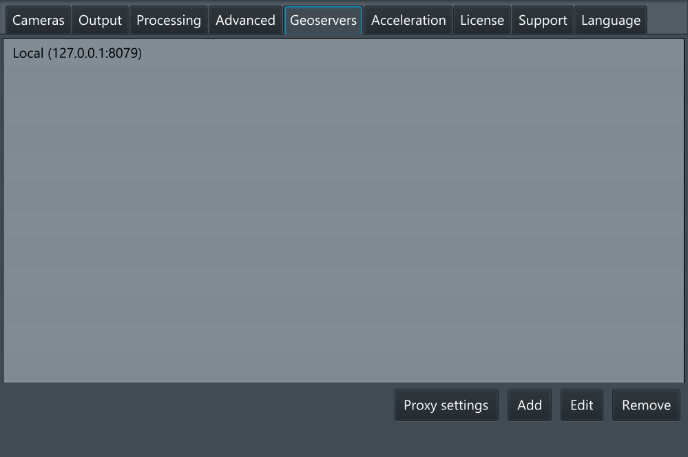
This tab is used to indicate the server address for the data that is being sent. By default, is set to the local computer. To change it, click the “Add” button and enter the required address.
Note, that it’s possible to have several servers added to the list. To edit server address, select it by right-clicking and click “Edit”.
Note: During orthophoto stitching, UgCS Mapper will use the first server in the list. In case it is not available, the warning window will appear asking to select the correct server. During publishing, UgCS mapper will ask first, which server to use.
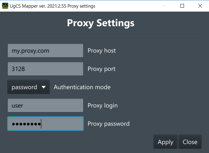
If you work on network behind proxy you can configure it with “Proxy settings” button. It opens up a such dialog:

Mapper supports these modes of a proxy, selected with the Authentication mode list:
• None – do not use any proxy settings
• Noauth – use proxy without authentication
• System – use system-wide proxy settings configured in the operation system
• Password – use the username and password to authenticate with the proxy server
In any mode except “None” and “System” proxy host and proxy port are required. These are used to connect proxy for any requests.
If you need to authenticate with proxy server in “System” or “Password” mode you can enter them in “Proxy login” and “Proxy password”.
Acceleration

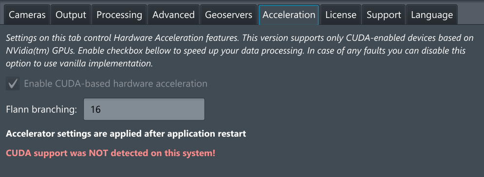
The tab is used to enable or disable hardware acceleration features. Only NVidia CUDA 10 compatible GPUs are supported at this time.
Note: In case of hardware issues during orthophoto stitching, turn off the CUDA acceleration and restart the UgCS Mapper.
License

Activate or deactivate the copy of UgCS Mapper here.
The name of the activated license is available on this screen.
Support
Settings in this tab are intended for extended troubleshooting information gathering. They are not affecting the processing result and are not supposed to be change in regular use.
Save error report – generates a zip file with logs that are supposed to be provided to tech support for the investigation
The preserve workspace checkmark is intended to preserve all the temporary files generated by the mapper for deep investigation and is only required by the tech support request

Language

Language selection tab. Mapper supports this localization of user interface:
• English
• Spanish
• Russian
Updated 6 months ago
